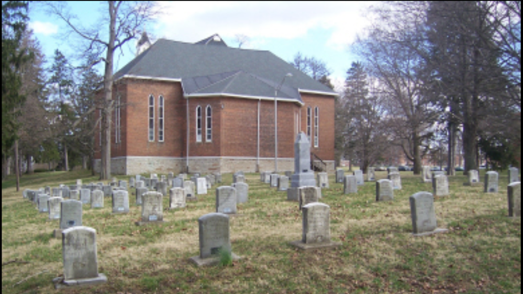
Greene County Historical Society
"Preserving Greene County's Past for Future Generations."
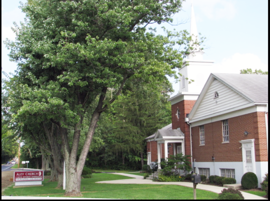
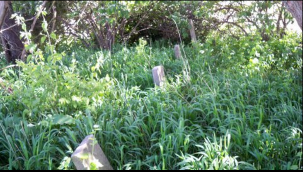
Aley Cemetery
The cemetery is situated in the northwest part of Beavercreek, on land set aside in the early 1800s by Jacob Aley, on his farm. The church and cemetery are named in honor of him. One of the earliest burials bears the year 1813 as the burial date for Isaac Aley. However, it is known that there are unmarked graves, with no records as to location or occupant.
4159 Kemp Rd, Beavercreek, OH 45431

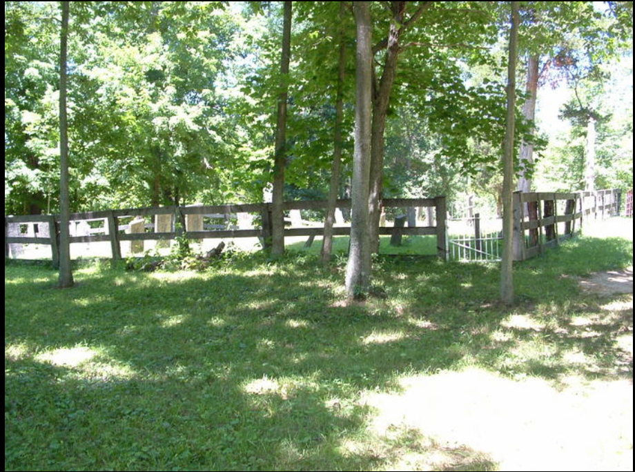
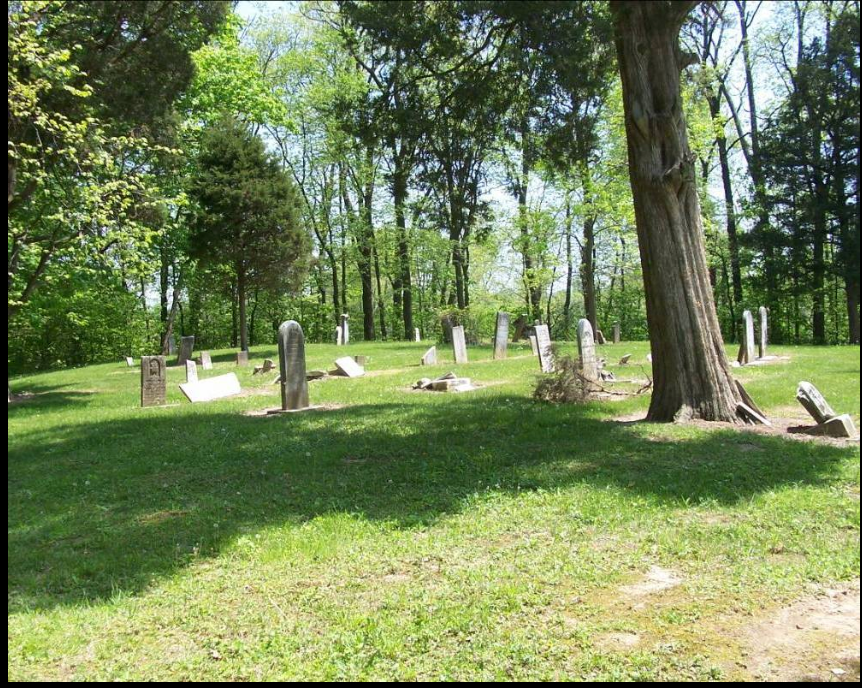
Beavercreek Township Cemetery
Brief History: Beaver Cemetery, Beavercreek Township
Stones with verses and epitaphs are all through this cemetery, many with lovely carvings such as weeping willows, roses, drapery, trains, and flags. Names include Ankeney, Hanes, Lantz, and Tobias; these are families after which roads were named in the township. Early dates are from the 1820s; burials include Civil War veterans as well as those who died during that war. David Steel, who died in 1863 after the battle of Stone River TN, is buried here, along with his wife Mary, who died in 1859 at Bloomfield IA. W. H. H. Fauber died at age 23, part of the 94th Ohio Volunteer Infantry; his stone has a great deal of information. This is a well-laid-out cemetery, originally associated with the German Reformed Church, located on the north side of Dayton-Xenia Road.
1180 Dayton Xenia Rd, Beavercreek Township, OH 45434
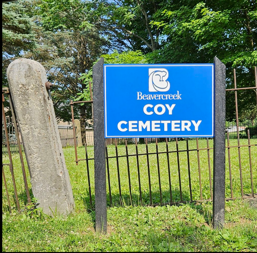
Coy Cemetery
Coy Cemetery is located at the southeast corner of North-Fairfield and Shakertown Roads, formerly the Jacob Coy Farm of 1809.
The Coy Cemetery was 1 of the 1st cemeteries in Beavercreek Township. Family names found on the gravestones are Brown, Coy, and Schmeltzer, with 8 burials dating from 1814 to 1877.
There are few headstones in the cemetery, perhaps only 8 in number. There is an assumption that many other Coy family members are buried there, but no records exist of the actual burial locations. Reliable data that states Jacob’s 2nd daughter Catherine Coy Schmeltzer (1778-1802), to be the 1st 1 buried there. The families had just arrived to Beavercreek, she must not have made the journey well or could have died in childbirth.
Relocation of graves from the Schmidt Cemetery during construction of the Fox Ridge Subdivision, the cemetery and only 1 box was found for disinterment. During construction of Sunset Bluff Subdivision uncovered 2 unmarked burials near the top of the hill overlooking the city. No analysis was performed except that coroner may have said they may have been victims of the flu epidemic of 1917-1918. The remains of these 2 cemeteries were relocated to the Coy Cemetery
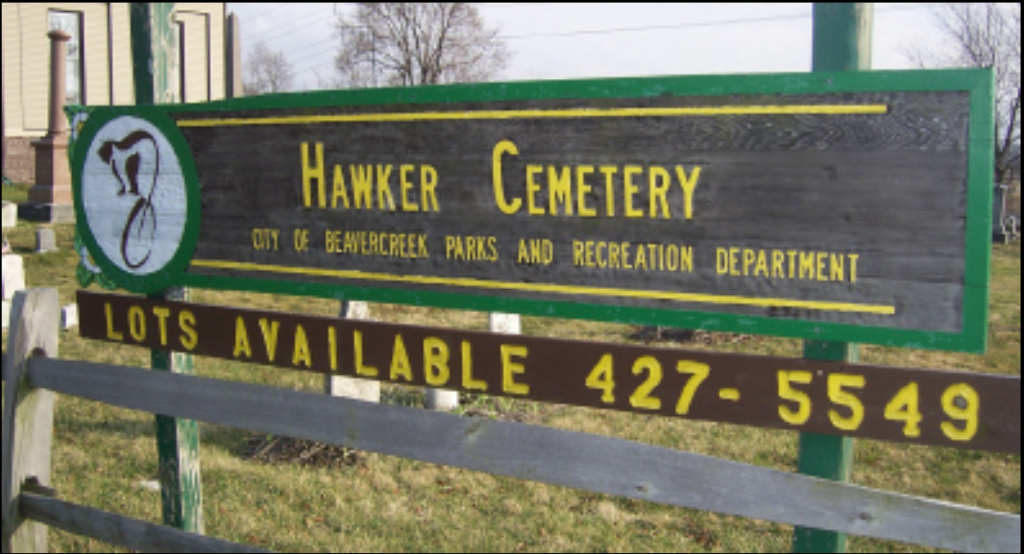
Hawker Cemetery
Brief History: Hawker Cemetery is an active, historic burial ground located at 4197 Dayton-Xenia Road in Beavercreek, Ohio, adjacent to Calvary Church. Established in the early 19th century (earliest burial 1809), it features early American graves, a small mausoleum, and is managed by township trustees. It was historically affiliated with the German Reformed Church.
Sunnyside Cemetery
(Old Pisgah Cemetery)
Located on North Fairfield Road, just north of Kemp Road. On the site of old Mount Pisgah German Reformed Church, which held services as early as 1809. The cemetery is also known as Old Pisgah Cemetery. The land was owned by Jonathan Harshman. The earliest known burial was John Helmer in 1823. Surnames of Cyphers, Goldshot, Harshman, Howett, Koogler, Reigelsperger, Sensenbaugh, Swigert, and Trubee are found on the gravestones. The last known burial was in 1957. The cemetery remains a “tiny cemetery” preserved in the midst of modern development. It is located near the Beavercreek Goodwill Store and is maintained by the City of Beavercreek. The north-central area of the township was a collection of large tract farms, owned by G.B. LaFong, the Koogler, Lantz, Tobias and Harner families amongst others. There were no ‘towns’ in the immediate area, so travels to New Germany, Byron, Zimmerman and Trebein were common.
George Zimmerman Cemetery
also known as Haverstick Cemetery, Harshman Cemetery & Koogler Cemetery
Located on Dayton-Xenia Road, just east of Fire Station No. 62 also known as the Haverstick Cemetery. Located on the John Durnbaugh Farm; formally owned by the Kooglers, and in 1883, by Catherine Haverstick. Headstones of 4 adults still standing, but there were at least 4 other adults and some children buried here. George Zimmerman was born in February 1779, in Washington, Maryland, United States, his father, Henry Zimmerman, was 25 and his mother, Anna Gertraute Herman, was 26. He married Nancy Durnbaugh about 1800. They were the parents of at least 2 sons and 4 daughters. He died on 27 October 1818, in Beavercreek Township, Greene, Ohio, United States, at the age of 39, and was buried in Beavercreek Township, Greene, Ohio, United States.
- The four known burials are:
- Dr. George Zimmerman – one of the first doctors in Beavercreek
- Nancy Durnbaugh Zimmerman
- Philip Harshman
- Frances Harshman
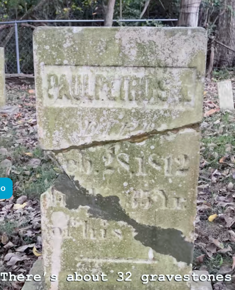
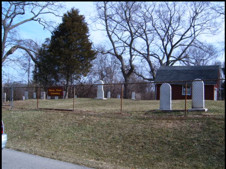
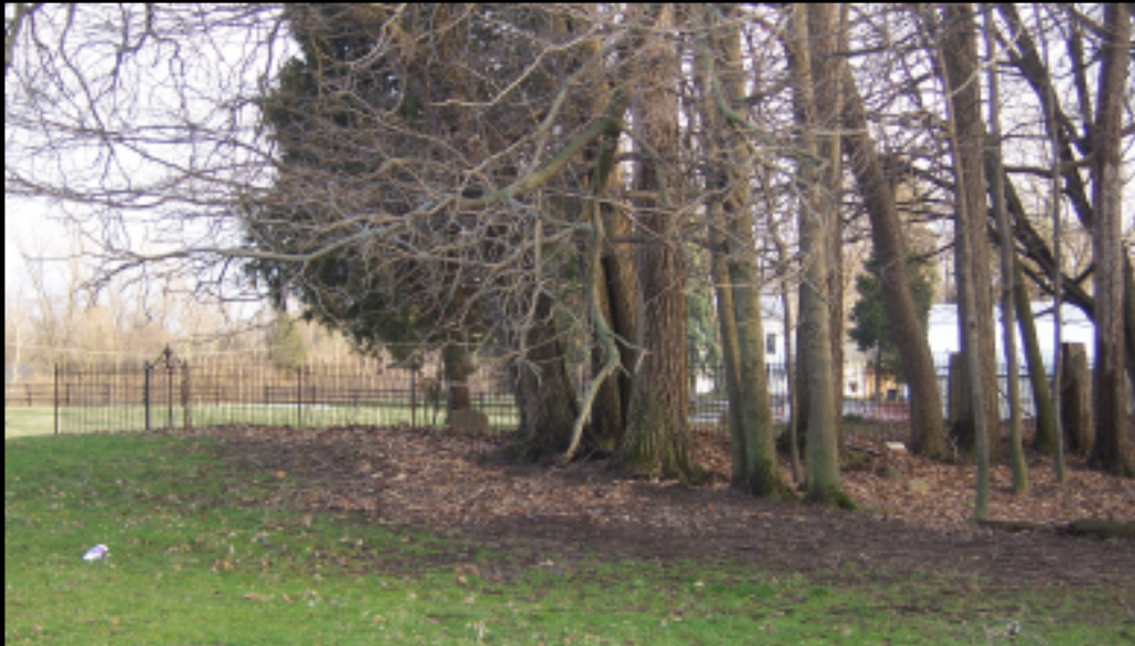
Reese-Petro Cemetery
Located on Unity Drive, tucked away in a residential neighborhood. Established on the Reese homestead, which was purchased in 1800. The cemetery is located on the east side of Unity Drive, which is off Pascal Drive. The Reese family and Petro family were neighbors and friends. The cemetery contains 32 gravestones, including Reese, Petro, Ankeney, Booker, Duncan, Grindle, Miller, Stewart, Trubee, and Warner.
Schmidt Cemetery
also known as Nesbitt & Fryborger Cemetery
No longer in existence but was located west of Beaver Valley Road, across from the Siegenthalers land. Established in 1828, presumably to bury Samuel Nesbitt, the son of Jacob Nesbitt, one of the first settlers of Beavercreek. The graves were relocated to the Coy Cemetery when the Fox Ridge subdivision was built. 12 years later, Kilner went back to discover that the cemetery had been built over by a housing development. The burials were not relocated or reinterred, but instead the builders had placed steel stakes underground marking the four corners of the cemetery. Kilner took one more picture of the front yard of the house built over the cemetery and donated that picture to the GCHS.
Hering Cemetery
Also known as Howell Cemetery
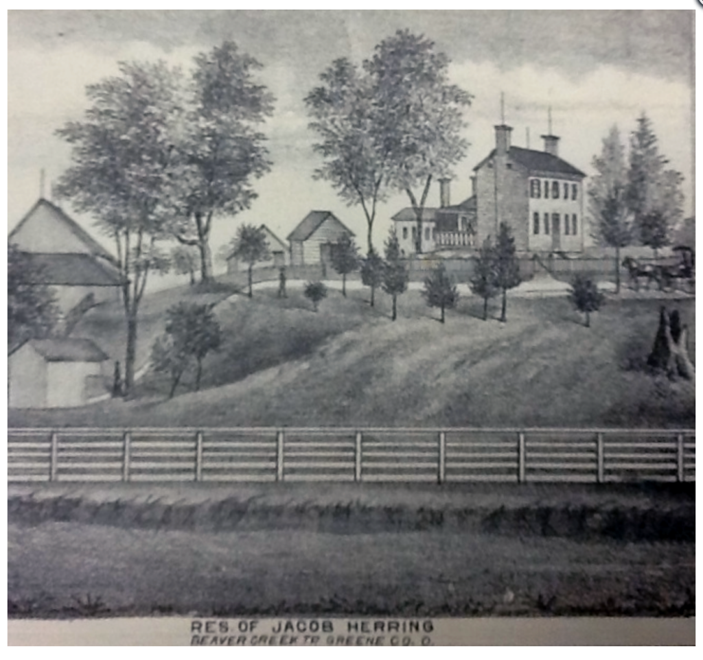
Also known as Hering Cemetery it is located on the original Hering Farm in Beavercreek Township slightly southwest of what was Howell’s Apple Orchard in 1987 (earlier it was King’s Orchard and more recently Harshman’s Orchard), Beaver Valley Road. he areas east and west of Beaver Valley Road and south to Obetz Drive were 334 acres owned by Jacob Herring. When the settling of Beavercreek was still underway, Mr. Herring who owned a tract of land near the creek in Alpha, heard that a fertile ground north of town was available. General Benjamin Whiteman Jr., Major General during the War of 1812, famed leader of expeditions against the Shawnee, son-in-law of pioneer Owen Davis and one of the area’s original settlers, learned of Herring’s desire to acquire the land. He approached Herring and negotiated a price of five dollars per acre for the tract. Unbeknownst to Mr. Herring, the land was an unclaimed land grant and not owned by General Whiteman. After consummating the deal, Whiteman immediately went to Cincinnati and entered it into his own name at less than two dollars and fifty cents per acre. He then re-sold the land to Mr. Herring for nearly a thousand-dollar profit! Beavercreek, Greene County, Ohio. On October 17, 1987, local author Arthur R. Kilner, “Greene County Past & Present”, took 8 photographs of the remaining stones in the cemetery, which was in the middle of woodsy property belonging to Mr. Howell of Howell’s Apple Orchard. These photos were donated to the Greene County Historical Society.
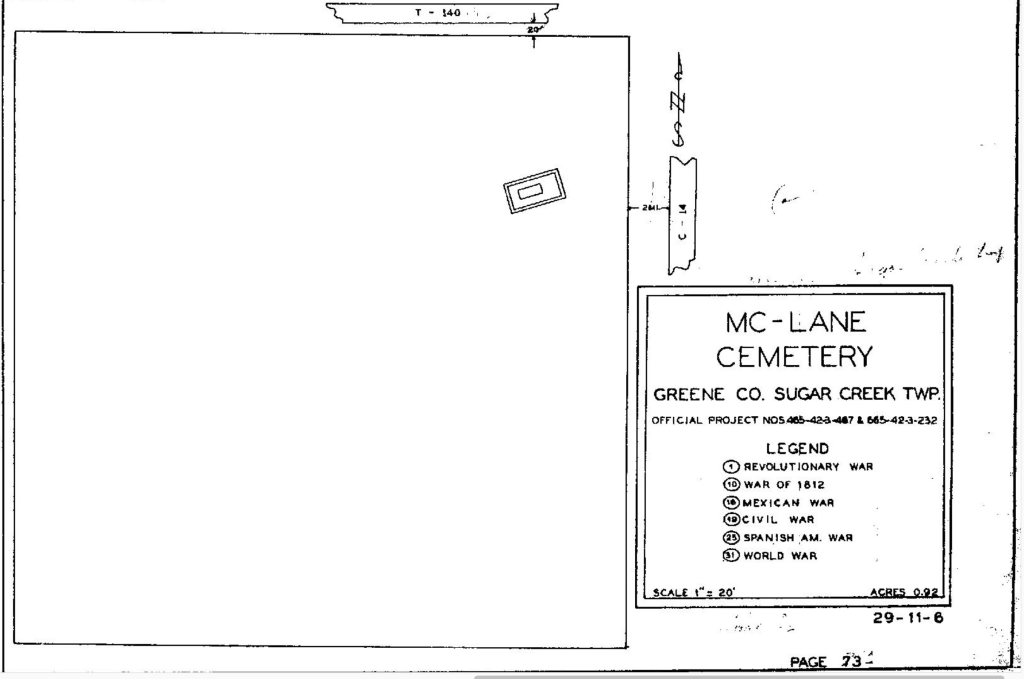
McLane/McLean Cemetery
Located On Old Huston Farm, Tombstone In Front Yard At 4169 Swigert Rd. The cemetery is located in Sugar Creek Township, Greene County, Ohio, and is # 4315 (McLane Cemetery / McLean Cemetery / Huston Cemetery) in “Ohio Cemeteries 1803-2003”, compiled by the Ohio Genealogical Society.
Coordinates: 39.67359, -84.10196
Morgan Cemetery
This cemetery is on private property and permission needs to be obtained to visit it.
this cemetery is in Beavercreek Township (northeast corner of Section 3 Township 3 Range 7) about 1400 feet east of Hilltop Road about 0.4 miles southwest of its junction with E Xenia Drive (Ohio State Route 235).
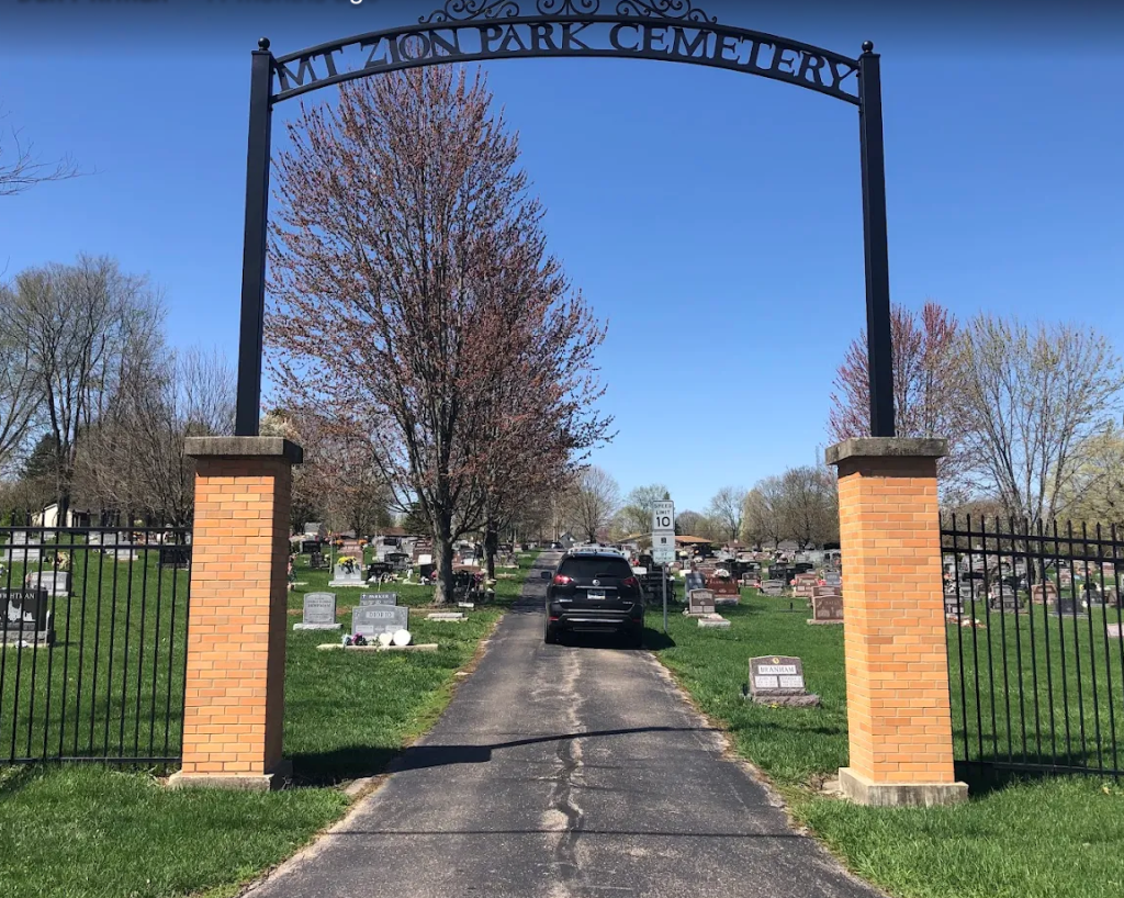
Mount Zion Park Cemetery & Mount Zion Shoup Cemetery
Also Known as Bowen Family Cemetery
This active cemetery is located on the southwest corner of the intersection of Indian Ripple Road and S. Fairfield Road. The cemetery is 8.75 acres in size and is currently owned and managed by the city of Beavercreek. The cemetery sexton for all cemeteries managed by the city of Beavercreek has an office in this cemetery. The earliest burial in the cemetery occurred in 1815. The cemetery was originally the Bowen Family Cemetery. Beavercreek Township assumed management of the cemetery in October 1961. When the city of Beavercreek was incorporated in 1980, the township transferred cemetery ownership and management to the city.
The cemetery is in Beavercreek Township, Greene County, Ohio and is # 4239 (Mount Zion Park Cemetery / Mount Zion Cemetery) in “Ohio Cemeteries 1803-2003”, compiled by the Ohio Genealogical Society.
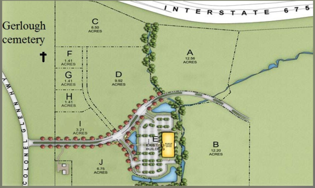
Gerlaugh Cemetery
Johann Henreich Garlock or John Henry Garlough arrived in Ohio in 1807. Their son Adam Garbough had shared title to this land with Judge Spinning. Cemetery was behind the home that is long gone. There are about 100 graves. The last standing tombstone was the brother of Mrs. Gerlaugh. Mission point is now using part of the old farm on back lot. Most of the property has been regraded. The farm was sold in 2007. The local people will remember the landmark was a squirrel corn sign FORSALE. the cattle around the small cliffs of the creek. very scenic. It will be missed. more pictures will be taken later. Section 11 Beavercreek township Colonel Glen Highway.
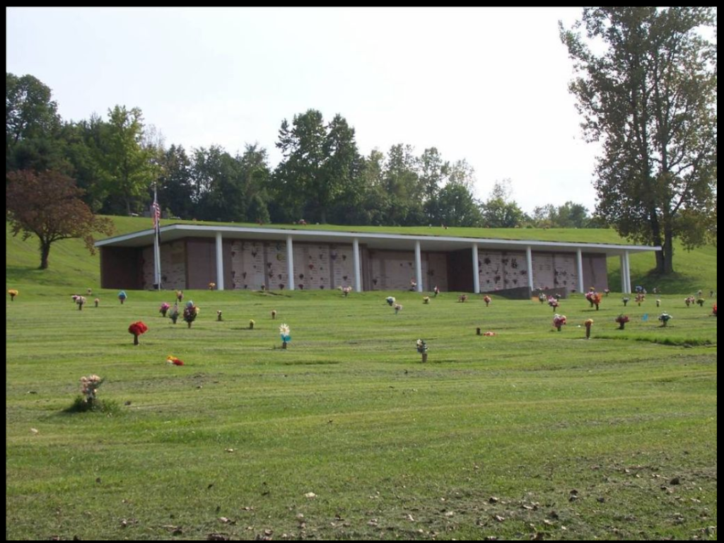
Queen of Heaven Cemetery
When the cemetery at Nazareth (the original name of the University of Dayton property) was closed in 1960 because of space concerns on the campus, a new cemetery was begun at Mount St John (Beavercreek) in Greene County, Ohio, named Queen of Heaven Cemetery.
George Zimmerman Cemetery
Zimmerman Cemetery is located south side of Dayton-Xenia Road in the lot next to Fire Station No. 62 on the John Durnbaugh Farm of 1874. There are headstones of only 4 adults still standing but at least 4 other adults were buried here along with young children. These are all well-known Beavercreek pioneers. In 1883 Catherine Haverstick owned the farm on with the cemetery is located. The Koogler family inherited this farm from his grandmother Catherine Haverstick, before going to the current owner of adjacent property John Durnbaugh.
Burials
- Dr. George Zimmerman (1779-1818), 1 of Beavercreek’s early doctors
- Nancy, his wife (Unknown-1829)
- Philip Harshman (1777-March 18, 1845)
- Frances Harshman (1785-1829)

Allen-Hawkins Cemetery
In the woods behind the original Hawkins property on east side of Hawkins Road, northeast of the intersection of Dayton-Xenia and Hawkins Road. First grave was in 1818, Davis Alle3 other family members are there. The cemetery is located in Xenia Township, Greene County, Ohio, and is # 4319 (Allen Cemetery / Hawkins Cemetery) in “Ohio Cemeteries 1803-2003”, compiled by the Ohio Genealogical Society.

Andrews Farm Cemetery
This cemetery appears in the WPA Cemetery book located in the Greene Co. Recorder’s Office (now Greene Co. Archives). This source states that the location is on Hilltop Rd. in Beavercreek Twp. One mile north of the old Trebein Road bridge intersection (Now Harlow Lane and Hilltop Rd intersection). Twenty feet to the right of the road. It is no longer marked or in existence. Robinson’s Greene Co. history lists several burials of the Crow/Gray family here in the early 1800’s. Greene Co. cemetery books (Greene Co. Room, Greene Co. Library, Xenia, Oh.) state the cemetery is further up the road on the left side on a private residence where one grave for a doctor is located. That grave is not located in the SW quarter of Section 8 and therefore is not on the old Samuel Andrew’s farm property that was purchased from Abraham Baughman who was the original purchaser of the SW quarter of section 8 for auction by William A. Burrous executor of the estate of Mathias Crow/Gray ca 1835. See Chancery Court records in the Greene Co. Rm.
Associate Church Cemetery
The cemetery was located on the north side of West Market Street on the side of the old McKinley School (288 W. Market Street), which was destroyed in the 1974 Xenia tornado. The burials were moved to Woodland Cemetery. The location is now the Xenia Towne Square Shopping Center. The cemetery was in Xenia Township, Greene County, Ohio, and is # 4340 (Associate Church Cemetery) in “Ohio Cemeteries 1803-2003”, compiled by the Ohio Genealogical Society.
Bonner Family Cemetery
The Bonner Family Cemetery is on the private property farm of the late Edwin Wolf.
Major renovations were accomplished in the 1970’s by members of the community and Faith Community United Methodist Church in Xenia. The burial yard was measured and charted, the stones were removed, cleaned and reset in cement bases, the fences were replaced with wrought iron fencing taken from the First Methodist Church, and the brick wall was cleaned and repointed.
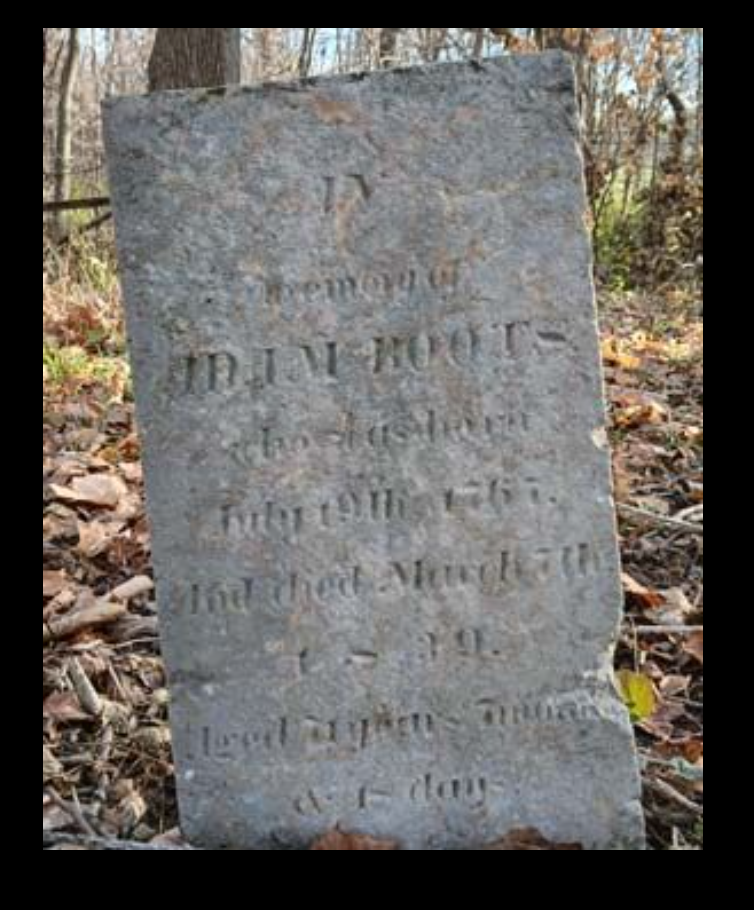
Boots Cemetery
also called Foy Ford Cemetery
Boots Cemetery, located in Caesar Creek Township near Xenia, Ohio, is a historic pioneer burial ground dating back to the early 19th century. It contains graves of early settlers, including Mallow and Fudge family members, with burials recorded between 1830 and the 1860s, and is sometimes known for its rural, overgrown, and partially lost, historic headstones. The cemetery is located about 300 feet east of E. Hoop Road about 0.5 miles northwest of Long Road. The cemetery is located in New Jasper Township, Greene County, Ohio, and is # 4279 (Boots Cemetery / Foy Ford Cemetery) in “Ohio Cemeteries 1803-2003”, compiled by the Ohio Genealogical Society.
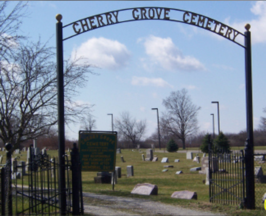
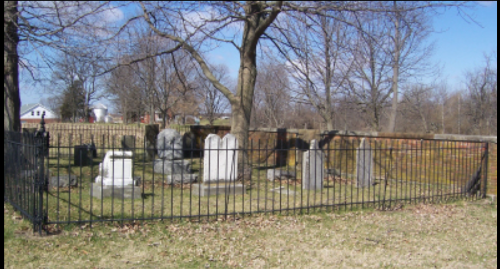
Cherry Grove Cemetery
Cherry Grove Cemetery, located at 946 E Market St, Xenia, Ohio (45385), is a historic burial ground associated with the Cherry Grove Cemetery Association. It is notable as the resting place of early Black settler descendants and community members, including Lincoln F. Brown (1866–1928), a carpenter and inventor, notes the Greene County Ohio Historical Society
East Church Street Cemetery
The cemetery was located on the south side of East Church Street between N. Fair Street and Evans Street. In 2002, the location was a school playground. The East Church Street Cemetery (also known as the Gowdy or Old Associate Reformed Cemetery) in Xenia, Ohio, was one of the town’s earliest burial grounds, established in the early 19th century. Located in the 500 block of East Third Street, it was active until about 1849, after which many burials were moved to Woodland Cemetery, leaving it a historical, abandoned, or removed site.
- The Gowdy Associate Reformed Cemetery, located in the 500 block of East Third Street in Xenia, Ohio, is a historic pioneer cemetery established around 1820. It served the Associate Reformed Church before closing in 1849, with notable burials including Revolutionary War and War of 1812 veterans. It is sometimes called the Old Associate Reformed Cemetery. Establishment: The land was originally owned by Samuel Gowdy, who sold it to the Associate Reformed Church in 1820 for 50 cents.
- Location: Situated in Xenia Township, Greene County, specifically noted in the 500 block of E. Third Street (often associated with the E. Church/Third Street corridor).
- Closure: The cemetery was largely discontinued around 1849 with the opening of Woodland Cemetery.
Davis Cemetery
The cemetery has been moved to Woodland Cemetery. Its original location was on the Davis property on the east side of Union Road.
Heath Cemetery
Heath Cemetery in Xenia Township, Ohio, located at Bellbrook Road and Route 68 South, is a small, historic pioneer burial ground dating back to the early 1800s. It holds approximately 11 recorded burials, including members of the Heath family (Jacob G. Heath, Daniel Heath) and early Greene County settlers. Known as a pioneer cemetery serving the area in the early 19th century.
Coordinates: 39.64985, -83.90735
On Bell Road at the intersection with Rte. 68 South in Xenia Township
Lloyd Cemetery
Located in a field southeast of the intersection of U.S. Rte. 68S and Bell Road. This cemetery is in a clump of trees in a cornfield.
McDonald Cemetery - McDaniel/McDonald Baptist Cemetery
Also known as McDaniel/McDonald Baptist Cemetery located on the former Isiah McDonald homestead at 1446 Stone Road, Xenia, Greene County, Ohio. More recently owned by the Lott family and then by Marge Lott Bodwell. From Stone Road you must turn down a lane towards a house. As you approach the house, this road goes off to the right. Follow it past the pond and up the hill to the cemetery. (10/22/12)
Methodist Cemetery
The Methodist Cemetery in Xenia, Ohio, was an early 19th-century burial ground located on Water Street. It was used by early Xenia residents but was abandoned and sold by court order around the time Woodland Cemetery was established, a process that accelerated around 1847 to 1849 as part of a move toward consolidated. Like other early churchyards (such as the German Reformed cemetery on Church Street), the Methodist burial ground on Water Street was closed when Woodland Cemetery was established in 1847.
Ohio Veterans' Children's Home
1869 – Grand Army of the Republic (GAR), veterans’ organization of Union soldiers who fought in American Civil War, established Ohio Soldiers’ and Sailors’ Orphans’ Home in Xenia, Ohio, predecessor of Ohio Veterans’ Children’s Home.
–1870 – 75 children at the home and State of Ohio assumed control. Xenia residents provided 150 acres to build permanent housing for Ohio children who lost fathers in American Civil War. Eventually the State opened residence to orphans of all military conflicts, children of all veterans, including some children who, due to family financial difficulties, were left at the home.
–1901 – 900 children at the home, making the facility the largest institution of its kind in the world. They received traditional education, occupational and military training, and lived in cottages with 40-50 per cottage.
–1978 – became known as Ohio Veterans’ Children’s Home
–1997 – ceased operations
–1998 – property sold to Legacy Ministries International, which leases the site to different businesses and organizations including a retirement community, a Christian school, and the international headquarters of Athletes-in-Action. Every year, a reunion of former pupils is held.
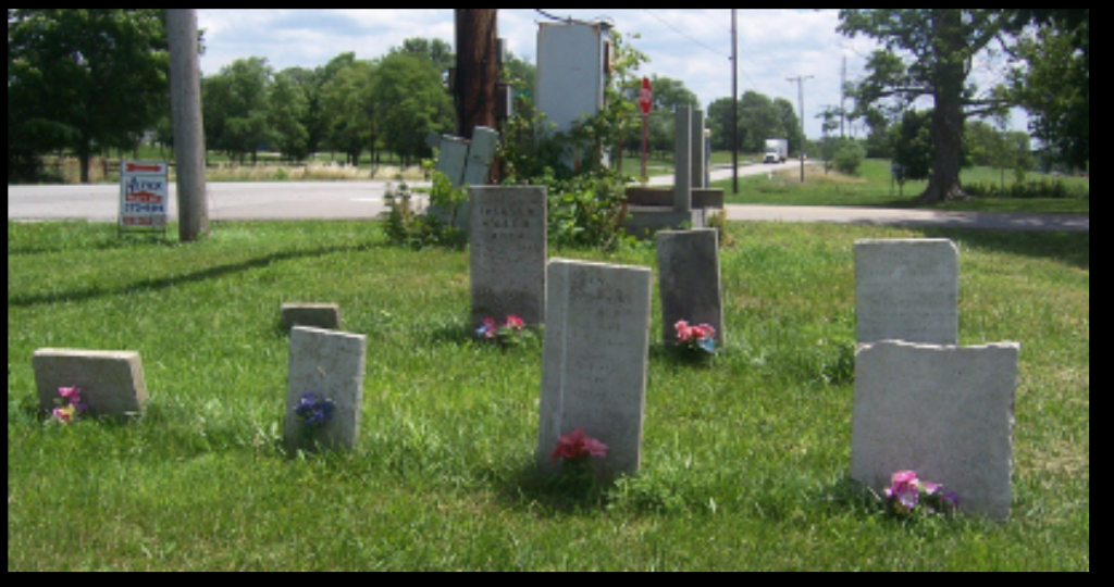
Stevensons Cemetery
Stevenson Cemetery, Also, known as Massie’s Creek Scotch Associate Graveyard. Greene County, Xenia Twp, Ohio. On Jones Road just North of Wilberforce. Stevenson Cemetery in Greene County, Ohio, is a historic burial ground established in the early 19th century, holding the remains of numerous early settlers, including Revolutionary War, War of 1812, and Civil War veterans. Located on Massie Creek, it is closely tied to the pioneer history of Xenia Township and has been maintained by the Daughters of the American Revolution (DAR).
Shook Cemetery
Cemetery located on the private driveway to 2300 E. Hoop Road, Jasper Twp., Greene County, Ohio. Shook Cemetery in Xenia, Ohio, is a historic, small pioneer burial ground located in Greene County. It contains graves dating back to the mid-19th century and has recently been part of a community volunteer project aimed at restoring and preserving old headstones for local veterans and residents. Records indicate interments occurred here in the mid-1800s, with various families, such as the Shooks and Longs, holding plots. It serves as a final resting place for early pioneers, often preserving the stories of Xenia’s early settler families.
Woodland Cemetery
Woodland Cemetery is a rural, park-like cemetery, which style was made popular by Mount Auburn Cem in Cambridge MA, dated 1831. First president of WCA was Elias F. Drake, banker, newspaper publisher, and politician. Cemetery board meetings went on for 2 years before directors were chosen! Howard Daniels, a Cincinnati landscape gardener, architect, and draftsman, was hired by the board sometime between Dec 1847 and Feb 1848. The earliest extant plan of the cemetery is from an 1852 map of Xenia, which can be seen at the Greene County Room, Xenia library. A noteworthy feature is that there are no single-family mausoleums on the site despite Woodland being the resting place of several locally prominent families. The cemetery contains 60 acres.
Many family and rural cemeteries were moved to Woodland, as well as the German Reformed cemetery which was on Church St, the Methodist on Third St, and the Associate at Market and West (later the site of McKinley Elementary and now Xenia Towers). The Associate Reformed or Gowdy cemetery is still located on East Third but has not been active since the 1850s.